Workshop Series: Creating Dynamic Web Maps
Looking to jazz up a presentation or digital project with map points annotated by pop-up text, images, and multimedia? Come to this two-part workshop series!

Creating Web Maps, Part 1 – Using ArcGIS Online
Monday, February 6, 2017, 2:00pm – 3:00pm, CURVE (Library South 2nd floor) – REGISTER HERE
This workshop will cover how to create online maps that can display point locations with pop-up text and images, such as this example. Participants will also learn how to easily add to and update your map. We will use the free version of ArcGIS Online and Google Sheets. All participants will need to have a Gmail account.
 Creating Web Maps, Part 2 – Using Esri’s Story Maps
Wednesday, February 8, 2017, 2:00pm – 3:00pm, CURVE (Library South 2nd floor) – REGISTER HERE
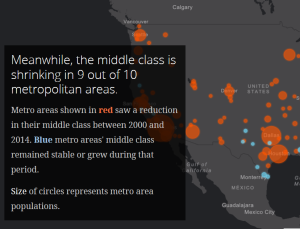
This workshop builds on the skills learned in the Creating Web Maps, Part 1 – Using ArcGIS Online workshop. Participants will learn how to combine multiple forms of digital media and ArcGIS Online maps by using the Esri Story Maps platform to tell stories where spatial dimensions play important roles, such as this Story Map.
Presenter: Joe Hurley, our Data Services and GIS Librarian.
Questions? Ask Joe Hurley.
Learn more about upcoming data-related workshops and the Library’s other data services & support offerings here!