GSU Library’s new online exhibit, “The Elevated City,” bridges Atlanta’s architectural past and present
Have you ever wondered why downtown Atlanta has so many bridges, viaducts, and underground areas?
The answer is not just the quirks of a growing city. The story behind Atlanta’s layers of elevated streets, hidden storefronts, and other structural oddities is one of bold planning, ambitious visions, and the challenges of connecting people in a place originally built to move freight.
A new online exhibit from the Georgia State University Library, titled “The Elevated City: Atlanta, a new city of raised streets, platforms and plazas, rises from its railroad past,” explores the origins, evolution, and ongoing impact of Atlanta’s elevated infrastructure. It’s a fascinating look into the ideas that literally shaped downtown Atlanta and continue to shape it today.
“The Elevated City” is fully online and freely available at exhibits.library.gsu.edu/elevated-city.
From Rail Hub to Raised City
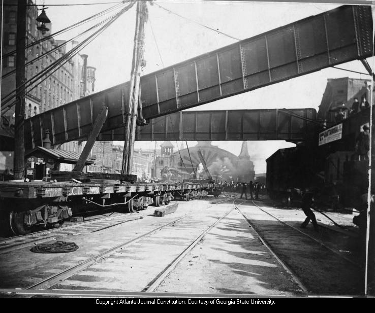
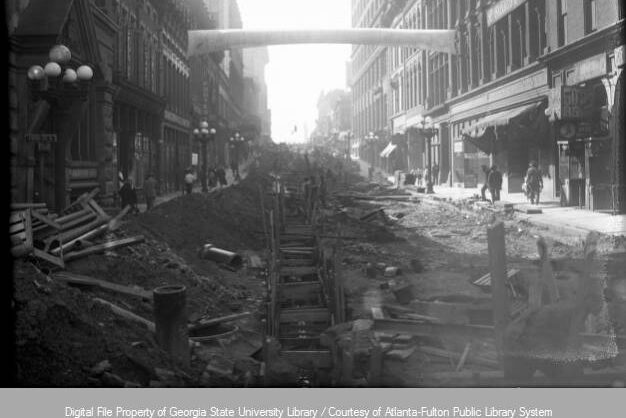
In the 19th and early 20th centuries, Atlanta’s downtown core was a booming hub of rail activity. But as automobile traffic grew, street-level crossings became increasingly dangerous and congested. City leaders, engineers, and architects began envisioning a new kind of city, one where people and vehicles would travel above the rail lines, freeing up the ground below.
The result? Viaducts, bridges, and platforms began to rise, creating the multi-level streetscape we still see today. “The Elevated City” traces the development of these changes, from the Twin Viaducts project of the 1920s, which would lead to the creation of Underground Atlanta, to Haralson Bleckley’s visionary plans for an elevated downtown of plazas and pedestrian walkways.
“The Elevated City” doesn’t just look back. It also connects these historical plans to today’s projects like Centennial Yards and The Stitch, both of which seek to reconnect fragmented parts of downtown through strategic development over rail and highway corridors.
“This exhibit is about more than infrastructure. It’s about understanding Atlanta’s inspirations and aspirations as the downtown evolved, including how Georgia State’s campus came to be,” says curator Bryan Sinclair, Associate Dean for Public Services at Georgia State University Library. “Atlanta’s raised streets tell the story of a city always looking for new ways to move forward, even if that means building upward.”
Collaboration in Action
The exhibit was developed by Sinclair with support from Master of Heritage Preservation student Jessica Brooks and the Library’s Digital Library Services Department. It draws on the previous research by Georgia State faculty emeriti including Drs. Timothy Crimmins and Harvey Newman, the work of Atlanta architect Andrew Steiner, who taught urban design at GSU, and the design of Joseph Perrin, who founded GSU’s School of Art and Design and helped to establish Underground Atlanta, to name just a few important GSU influencers.
This collaboration supports the university’s strategic pillars of Identity & Placemaking and Research & Discovery by making unique collections, historic maps, and primary sources more visible and accessible. At the same time, it speaks to Student Success and College to Career by giving students opportunities to explore how research connects with real-world challenges like urban design and community development.
Explore the Exhibit
“The Elevated City” is fully online and freely available at exhibits.library.gsu.edu/elevated-city. It includes narrative history, historic photographs, architectural plans, and links to archival materials that give visitors a deeper appreciation for how Atlanta’s downtown came to be and where it might go next.
Whether you’re an urban enthusiast, student researcher, or simply curious about the city’s history, the exhibit is a perfect starting point for understanding why downtown Atlanta looks and feels the way it does.